Crossing Switzerland by ski in 31 days (16 Feb - 17 Mar 2016)
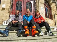
The 2015 journey from the Mediterranean to Mt Blanc was the most challenging and rewarding trip that I had experienced in 25 years of ski mountaineering. So it seemed logical to extend the project eastwards across Switzerland in 2016. Sadly my companion from the French trip, Venetia, was unavailable due to work commitments so I teamed up with Steve and John who had been planning a similar trip independently. The idea was elegant but uncompromising: to travel from Chamonix to Austria entirely by ski with no use of mechanical uplift or vehicle transport.
Initial research showed that this has rarely been attempted. Friends used their contacts in the Swiss Alpine Club to seek details of previous parties and routes but found little. I was surprised that such an obvious project had been ignored in a country with such a rich history of ski mountaineering. Several groups have made long crossings in the past but most have skied the 'obvious' sections and used buses or taxis to bypass the 'difficult' bits. My aim was to find viable ski routes through or around these difficult bits in order to create a continuous route. Identifying suitable accommodation (huts or village hotels) was the first stage followed by searching for suitable ski routes that linked these together. This involved hundreds of pounds of expenditure on Swiss maps and hundreds of hours of internet research. I concluded that given favourable snow and weather and a few rest days the trip could be done in 40 days.
Things started badly. The team gathered in Chamonix on 6 February aiming to start the following day. The weather was poor and the forecast bad for the week ahead. Friends who were due to join for the first stage cancelled and our start date was pushed back a week. I have skied Chamonix - Zermatt many times but not in the last decade. Initially it seemed a good idea to start the trip on familiar terrain, but the disadvantages of starting among Europe's highest peaks became apparent. Among lower mountains it would have been possible to push the route out in marginal weather but this was not advisable in serious glacial terrain.
The original plan was to follow the Grand Lui / Gd St Bernard route but huge snowfalls and high avalanche risk led us to select a lower level variation. We followed the summer TMB route via Trient, Col de la Forclaz & Champex to Orsieres before traversing the 2445m Six Blanc to Lourtiers and climbing to the Mt Fort hut. Fine weather for the first 4 days enabled us to make good progress despite the deep snow. We enjoyed great descents from Col de Balme and Chaux de Bovine on days 1 & 2 and were pleased to have found a way of forcing a route from Champex to the Mt Fort hut entirely on skis, even if this involved 3297m of climbing and 34km of travel in a little over 2 days. The climb to Mt Fort was achieved in bad weather and the following day was little better. We failed to find the route over the Rosablanche and diverted to the Prafleuri hut. The next day brought clear skies and sunshine and we headed to Arolla. Here John departed with a reoccurrence of a knee injury while Steve and I pushed on to the Bouquetins hut. Seven days after leaving Chamonix we had the mountains to ourselves and we made good time over the cols of Mt Brule and Valpelline to reach Zermatt in the early afternoon.
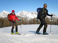
Here we took a rest day, replenished supplies and collected Harvey our new team member. We now resembled the 'odd bunch' with me on conventional touring skis, Steve on telemark skis and Harvey on a split board. The day out of Zermatt was always going to be long one. From the Bahnhof hotel to the Britanniahutte was 2493m of ascent and 28.4km of travel over 14.12hrs. A fair proportion of this was in poor weather and the last 2hrs in the dark. A short day day to Saas Grund allowed some time for rest before another long day to the Simplon Pass. This was a classic 11hr touring day with glorious weather, less than obvious route finding, a fantastic descent from the Simelipass, ending with poor weather navigation to the strange cylindrical Monte Leone hotel.
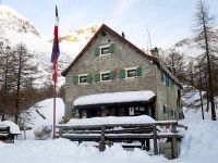
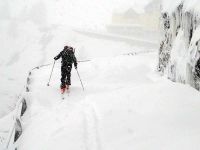
A major storm was forecast so we dropped down to Domodossola for 3 days to let this blow through. On 1 March we started the next leg of the trip from Simplon Pass, hoping to reach Airolo in 4-5 days. In the end it took 8 days. The route followed a section of the long distance summer hiking trail 'Via Alpina' and while it was shown as a ski route on Swiss maps it was definitely better suited to hiking than skiing. The weather was poor and our progress slow as we put in successive 10 and 11 hour days to force a route between winter rooms in Italian huts at Alpe Veglia and Alpe Devero. 3 March was a low point as unexpected bad weather forced us to retrace our tracks to the Castiglione hut after 12 hrs of effort failed to find the route over the Scatta Minoia. An improvement on the 4th enabled us to reach the Margaroli hut, and on the 5th we skied up the closed road to Riale in Val Formazza on a day when 80cm of snow fell. We had a rest day to allow avalanche conditions to subside before travelling to the Basodino hut on a cold windy day, and on to Airolo the next day in warm sunshine.
We felt that it would be foolish to have a rest day with good weather forecast and set out with supplies for 3 nights in unguarded huts on the 'Ticino haute route'. This was one of the most enjoyable sections of the trip. Good weather and good snow enabled us to travel at a steady rate. We covered 83km in 4 days (all between 8-10hrs) traversing interesting ground between excellent and comfortable huts at Cadagno, Bovarino and Adula. We met a lone German man in the first hut and a solitary skier on the day that we climbed the 3402m summit of the Rheinwaldhorn. We arrived in Splugen on 13 March tired, but happy.
There is no obvious ski route linking Splugen and Preda. Previous groups making Swiss traverses have used the Postbus or taxis to bypass this section but we were committed to making a continuous tour. We had planned a route via Monte Spluga and Innerferrera but found that the only hotel in this key village was closed and had to rethink the route ahead. We spent a half day working with maps, reprogramming the GPS and calling ahead to book hotels. The alternate route via Zillis and Savognin turned out much better than expected. In three days we covered 76km and climbed 5040m taking in the 2972m summit of Piz Curver.
On 18 March I ran out of time. I was due to fly to Nepal on the 24th to lead an Everest expedition and needed to return to the UK. An extra week would have taken me into Austria exiting the eastern end of the Silvretta, but the delayed start in mid February proved to be crucial. Steve and Harvey continued for another 6 days ending at Galtur in Austria on 23 March. For me the final days of the Swiss journey will have to wait for another year. TransAlp part III will start from Bergun and travel eastwards through Austria.
The alpine mountains in winter can be a savage and dangerous place. It is easy to be fooled by 'accurate' maps showing red lines linking 'obvious' passes but in poor weather even map, compass and GPS are no guarantee of safe passage. Micro features a few meters high can easily cause a broken leg and a night in the open without full camping equipment can be very unpleasant. Our pack weights were around 12-18 kg, which was just manageable. However the extra weight of camping kit would push this into 'unacceptable' territory. This is one of the key challenges of long distance hut to hut ski touring. Keeping pack weights reasonable by not carrying camping equipment while travelling in marginal conditions means accepting the risk of a night in the open.
There is no getting away from the fact that long point to point ski trips have significantly greater hazards than other forms of ski touring. At times we travelled in weather conditions and crossed snow slopes that most sensible people would avoid. Had we not done so we would not have made progress. We were not foolhardy but we set the threshold of acceptable risk much higher than most ski mountaineers would be comfortable with.
The numbers: 26 days moving, 5 days not moving (all weather related), 518km travelled, 30,621 meters of ascent.
David Hamilton March 2016


