This is the report of a trip that I made in the Hunza valley of the Karakoram in late summer 2008.
Reconnaissance Report 29 August - 10 September 2007
The town of Skardu in Northern Pakistan is the centre of Jagged Globe's operations in the Karakoram. On August 28th I waved goodbye to Mungo Ross and his team of 8 climbers as they departed the K2 hotel for Cathedral Peak. After the rush of preparing the supplies for this group I had most of the day free to check the equipment recently returned from the Muztag Ata expedition and the July and August K2 Base Camp Treks.
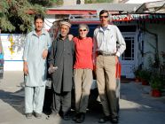
The following day I left for Hunza leading possibly the smallest Jagged Globe expedition of 2007. My partner Claire, myself, plus local guide Sharif and cook Ali easily fitted into a single Toyota Landcruiser with our luggage for the 10 hour drive to Hunza. We spent a pleasant evening in Karimabad, the historic capital of the Hunza Valley. This wonderfully situated town is the most popular tourist attraction in Northern Pakistan, yet remains virtually undiscovered compared to similar towns in neighbouring India and Nepal. The 600 year old Baltit Fort dominates the valley and is probably the most photographed building in the Karakoram. On the other side of the valley the snow covered peaks of Diran (7,266m) and Rakaposhi (7,788m) rise dramatically above the terraced fields.
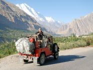
Next morning we left Karimabad in the company of Manzoor, a local jeep driver I have known for 20 years since my first journey to the Karakoram. In those days his father ran one of the first simple tourist hotels in the area. There are now more than a dozen good quality hotels in Karimabad, but the post 9/11 downturn in tourism means that they are rarely more than half full and good rooms can be had for very reasonable prices. The drive to Hopar took only one and half hours in the open top jeep - and will take even less when the new road is completed. Along the way we saw farmers collecting in the late season crops, while on the rooftops flat round trays of apricots were drying in the sun.
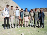
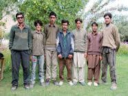
There are two simple hotels in Hopar. Manzoor recommended the Hopar Hilton, which at under £5 per night has to be one of the least expensive Hilton Hotels in the world. Complex negotiations were needed to understand the complexities of the local porter system, but next morning 5 porters were ready to carry our loads - plus 2 more to carry the food for the porters for the next 10 days.
Rush Peak is becoming a popular 4-5 day trek. However the rapid ascent profile means that many people attempting it without prior acclimatisation struggle. The trek to the Base Camp at the foot of Spantik's Golden Pillar is rarely attempted and is a great 5 day trek in its own right. Our plan was to create a 10 day programme that started with a trek to Spantik BC and ended with an ascent of Rush Peak. In the process we would circumnavigate the Barpu Glacier, trekking outwards on the West bank and returning along the East bank.
One unique feature of the glaciers near Hopar village is that they reach down to very low altitudes in the valleys. The Barpu and Bualter glaciers descend as low as 2,600m making them possibly the lowest glaciers in the Himalayas. So it is possible to trek in a landscape dominated by these huge rivers of ice without reaching very high altitudes.
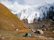
The trek started from Hopar (2,850m) and climbed down a steep track to the Bualter Glacier 200m lower. We crossed this in 30 minutes via a fairly straightforward path. Our plan envisaged 5 glacier crossings during the 10 day trek. In the end we did the 5 planned crossings plus 2 excursions onto the Upper Barpu Glacier on the way to Spantik BC. Most of the trek on day one followed a faint hillside path high above the Barpu Glacier on the way to a few small huts at Hamdar. Here we found clear running water, a grassy spot to pitch the tent on, several hundred sheep, and a lone shepherd making butter by hand in a traditional wooden churn. Typical for the terrain in this area the campsite perched on small path of level ground on a hillside overlooking a broad expanse of glacial ice several hundred meters bellow.
The next day we made an early start following the hillside above the glacier in a South East direction. Soon the hill became a steep cliff and the path changed into a narrow man made ledge. This had been carefully constructed from rocks supported by tree trunks driven into the cliff face ago by past generations to give access to grazing pastures close to the Miar Glacier. We dropped to the edge of this glacier and crossed the bare white ice to reach the forested ablation valley known locally as Sumayer Bar. This heavily wooded area continued for over 3km and we camped in a clearing next to some shepherds' huts about midway along. The following morning was again clear and there were great views of Spantik standing at the end of the valley. Reaching the end of the wooded area we struck out across the Upper Barpu glacier to reach its East bank. This crossing was trickier than the 2 previous, involving sections of loose stones as well as dirty black ice and took 90 minutes. Soon we were erecting out tents at another idyllic site overlooking peaks and glaciers known locally as Girgindil. We were now above the tree line and the vegetation consisted of dense bushes about 1m high that covered to hillsides surrounding camp. Autumn has well and truly arrived at this altitude and many of the bushes had turned golden shades of orange and yellow, looking particularly dramatic in the evening sunlight.
An unexpected diversion onto the glacier the next day added an extra twist to the trek and marked the start of an area unknown to most of our porters. Opinions on the length of the day, the availability of water and the location of our intended campsite varied. Eventually 4 hours of pleasant, and sometimes steep, trekking took us to Shuja Basa where the glacier from Spantik joined the main flow of the Barpu glacier originating in the icefields of Malubiting's North face. For 4 days we had trekked for 3-4 hours each morning reaching camp by lunchtime and leaving the afternoons free. On the fifth day we gave the porters a rest and for the first time did not move camp. Instead we climbed into a wide attractive 'hidden' valley and after 2 hours reached the 4,650m site of Spantik Base Camp.
Only a handful of expeditions have used this site since the British pair of Mick Fowler and Vic Saunders made their groundbreaking ascent of Spantik's Golden Pillar in 198x. Few trekkers venture this far up the Barpu Valley and the area was thankfully free of the rubbish that pollutes many of the more popular trekking areas in the Himalayas. Sadly there was quite a bit of low cloud obscuring the peaks above 6,000m and we were denied the close up view of Spantik that we had hoped for. There were fresh footprints of Ibex in the muddy streambed, but we scanned the hillsides vainly searching for a sighting of these elusive animals.
With the first part of the trek over it was time to turn northwards following the East bank of the Barpu glacier, dropping a lot of height on the way to our next campsite at Bericho Kor. This was the longest day of the trek and we covered three and a half 'porter stages' in 6 hours walking. First we retraced the route to Girgindil taking 2 hours to descend what had taken 4 hours to ascend. This despite time lost when our porters tried to bully a reluctant group of yaks to follow them down a precipitous cliff onto the glacier. A nice lunch spot was ignored at Chukutans where the porters spent quite a bit of time trying to commandeer two donkeys to carry their loads for the remainder of the day; one load stayed on, the other repeatedly fell off. From this point the path improved considerably and the terrain in the afternoon was much easier, although the temperatures became warmer as we dropped to lower altitudes and lost the cooling breeze from the glacier. At Bericho Kor the campsite was in a grove tall trees and we welcomed the shade they gave from the hot sun. The small stream was pleasantly warm and ideal for a much needed wash. We had brought sufficient food and fuel for the entire 10 day journey, but the porters had either brought insufficient supplies for themselves, or had been eating more than anticipated and now their supplies were running low. Two porters therefore made the round trip to Hopar in the middle of the night to fetch extra provisions.
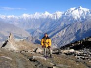
The nature of the trek changed considerably the next day with an unrelenting 1100m climb up a steep and dusty path to Chindin Harai. This camp is situated on the broad ridge separating the Barpu valley from the Hispar valley to the north. In former times the lands atop this ridge were used for grazing. Abandoned shepherds' huts and water channels remain. In recent years changing rainfall patterns and easier forms of income in the valleys have led to these marginal lands being abandoned. The ridge provides a fantastic vantage point from which to view the surrounding high mountains. The ridge running from NW to SE contains a number of shallow depressions, rounded hilltops and sharp pinnacles. Chidin Harai at a height of 4,366m offers a sheltered camping spot with a year round water source. A little more than an hour above, at a height of 4,662m lie the clear blue waters of Rush Lake framed by a ring of snow covered peaks. There are few vantage points in the Karakoram reachable by straightforward hikes that afford such dramatic views of the surrounding peaks.
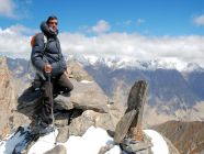
To the North lie the Hunza Peaks dominated by Ultar (7,388m). In the West Rakaposhi (7,788m) and Diran (7,266m) occupy the middle distance, while several seldom seen peaks of snow and ice fill the skyline to the Southwest: Miar (6,824m), Phuparash (6,574m), Malubiting (7,458), and Spantik (7,027m). The horizon to the East is filled with the chain of peaks separating the Hispar and Shimshal valleys including Lupgar Sar (7,200m), Momhil Sar (7,343m), Trivor (7,728m), Mulunguti Sar (7,025m), Distaghil Sar (7,885m) and Kunyang Chish (7,852m). Perhaps the best viewpoint in the locality is the rocky outcrop known as Rush Peak. This is about 2 hours above the waters of the lake. For one and half hours the trail crosses fairly gentle terrain made up of grassy tussocks and stones, before the final 30 minute climb over steep loose boulders. All the published maps give a summit height of 5,098m and I do not know how or when this was surveyed. My GPS gave a reading of 5,040m, so perhaps some further work is needed to determine the true height or perhaps the rock is so loose that 48m has fallen form the summit in recent years.
From the rocky summit there is a clear line of sight East to the 5151mHispar Pass at the junction of the Hispar and Biafo glaciers. On a clear day the peaks of Baintha Brakk / The Ogre (7,285m) and Latok (7145m) can be seen on the far side of the pass. It is said that K2 can be seen in the far distance, but this requires perfect weather conditions. Even with binoculars I could only vaguely identify the very hazy shape of a large triangle in the far distance and could not say for certain if it was K2.
We actually climbed to the summit of Rush Peak twice. On September 7th a thin layer of fresh snow lay on the ground. This was good for photographs but made the climb to the summit tricky. And when we got there low cloud obscured the more distant peaks. We returned the following day, leaving camp a little earlier, to beat the daily build up of clouds. All the new snow had vanished and the views were considerably better. This left us with a long descent, back to camp at Chidin Harai 680m below, and then on to Bericho Kor a further 1100m lower.
The drop in altitude resulted in a dramatic rise in temperature and we spent a pleasant afternoon relaxing in the shade of evergreen trees and washing in the small stream running through camp. The porters were now looking forward to the end of the trip and a return to their village. They spent hours washing their clothes and themselves and ended up looking much cleaner than us. The final day of the trek saw us cover the distance back to Hopar quickly. There was a good path down the wide ablation valley and flat areas of grass alternated with patches of trees and rocky sections. We passed several shepherds driving their flocks of sheep and goats back to the village before the onset of the cold weather marking the end of summer. The final two glacier crossings were easy and we crossed the Barpu and Bualter glaciers in 30 minutes each. It only remained to climb the steep slope of dried mud 200m from the glacier bed to the village. The first village at the top of the hill was the Hopar Hilton and we treated ourselves and the porters to a celebratory bottle of Pepsi (the strongest drink available). At least the bar bills were reasonable, and 11 bottles of Pepsi only set the budget back £2.50.
Although I have trekked and climbed in much of the Karakoram the Barpu glacier was new to me. The experience on this trek confirmed my belief that this is the best place in the Karakoram for a 'short trek'. Access is relatively quick and easy, the scenery spectacular, and the trekking varied and interesting. The reconnaissance trip was a very enjoyable end to my 2007 Karakoram season. I learnt a lot of helpful details that will be fed into planning the 2008 Jagged Globe trip to this area, and Sharif, who will be working with the trip next year made several good local contacts.
David Hamilton
Written on flight PK792 Islamabad to Birmingham 20/09/07
.

